
|
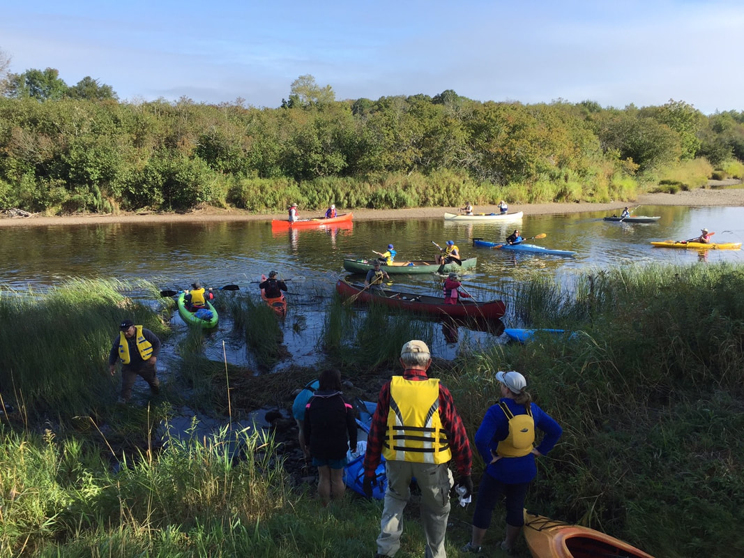
A paddlers paradiseWith 32 km of paddling at your fingertips, the St. Mary’s River is spectacular. There are two main branches of the river: the East Branch and the West Branch, which are equally stunning.
Before heading out - check our live water level readings from a data logger in the West Branch area. Here, you can watch the river level, pH and rainfall. Our logger reads in feet, and we recommend 2 and 1/2 feet of water for your West Branch paddling adventure. |
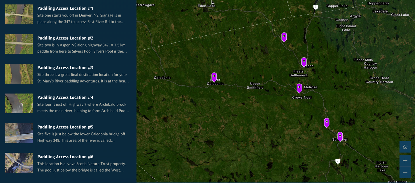
Paddling Access points
Find a perfect spot to launch along the river
PADDLERS TRAIL
In the Spring of 2017, we added river signs to the East Branch and Main Branch paddling excursions, with four of them as access points.
These signs have a “You Are Here” map, a QR code and the location name.
The QR code will link you to a location on our web page with angling information for the area, history, stories and pictures.
This paddling trail is roughly 20 km of river.
Paddle and learn about the local history around each cover throughout the river by taking a virtual tour.
a 24 hour river
St. Mary’s River will rise for approximately 24 hours and then start to fall again. If you are planning a paddling trip and decide to paddle the West branch of St. Mary’s with less than our recommended two-foot level, you may end up dragging your boat for much of the trip.
low water levels?If the water level is low, you may consider paddling the East branch. This branch does hold sufficient water for most of the summer. Starting at the Aspen bridge, paddle through the Glenelg lakes and the forks of the West and East Branches known as Silver’s Pool. Then continue past the old gold mines at the Bells of St. Mary’s, past Mitchel’s pool, the old Waternish Graveyard pool, and on to the Stillwater. You can paddle through the Stillwater or plan to get off the river here. If you paddle on through the Stillwater, you can plan to get out of the river just below the Ford pool at the mouth of Archibald’s brook. From here on, you will need substantially high water for a rock-free paddle.
|
|
One thing to note about this East Branch/Main Branch paddle is a possible headwind in the lake and Stillwater. These headwinds can be difficult to paddle against, and you should have a backup plan for such an encounter. If you want to get out of the river at the beginning of the Stillwater, you can contact us, and we will give you information on where would be a good location.
Get in Touch With Us
The St. Mary’s River, or Napu'saqnuk, was an essential waterway for the Mi’kmaq, who moved between seasonal hunting grounds and winter camping settlements. We acknowledge the Peace & Friendship Treaties signed in this Territory and recognize that we are all Treaty People.